Joe and Eoin's Journey to Paddle for the Peace and beyond
Friday, July 5, 2013
The Wilderness Committee's National Campaign Director Joe Foy and Climate Campaigner Eoin Madden are setting off on a journey to northern BC, to take part in the 8th Annual Paddle for the Peace and to document the effect that fracking is having on the northeastern region of the province.
During the month of July, we'll be documenting the adventure and posting updates, photos and video footage on this blog.
Tuesday, July 23, 2013
When will Canada finally get an honest job?
On Monday, we headed south to be in Williams Lake for the opening of the Federal Environmental Assessment hearings on Taseko Mines' proposed New Prosperity open-pit gold and copper mine. On the way we stopped to locate a small plaque in Quesnel that honours the Tsilhqot'in Chiefs who gave their lives in defence of their country against colonial forces in 1864.
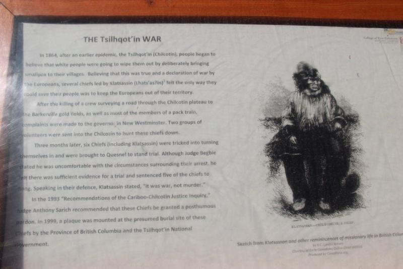
A plaque tells the story of the Tsilhqot'in war of 1864
Back in those days the issue was theft – the stealing of Tsilhqot'in lands and resources to support the new British colony's mining industry. It's a sad chapter in our history, and one that did not have to happen. The difference between fair trade and theft is not that far. In a trade, goods trade hands with consent. In theft, goods trade hands with no consent.
Back in 1864 when colonial road crews attempted to force a road through to the gold fields without Tsilhqot'in consent, all hell broke loose in what came to be known as the Chilcotin War. People died. The road project has never been completed.

Tsilhqot'in Nation members participate in a gathering and rally in opposition to the mine
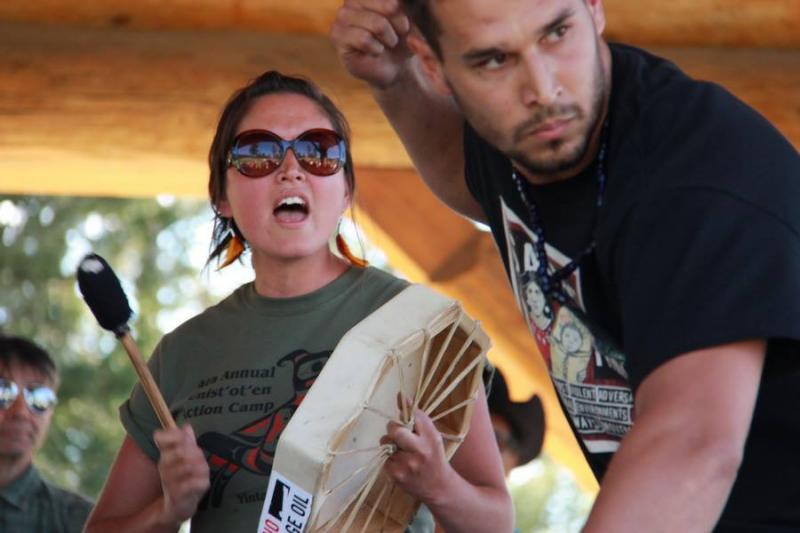
In Williams Lake we attended a gathering of a couple hundred Tsilhqot'in and their supporters, whose main message is that consent has not been given for the so-called New Prosperity Mine. Chiefs from the seven Tsilhqot'in communities and from First Nations around the province all spoke about their strong opposition to this mine. It was very moving to witness.

Chief Roger William of Nemiah

Former Chief Marilyn Baptiste of Nemiah
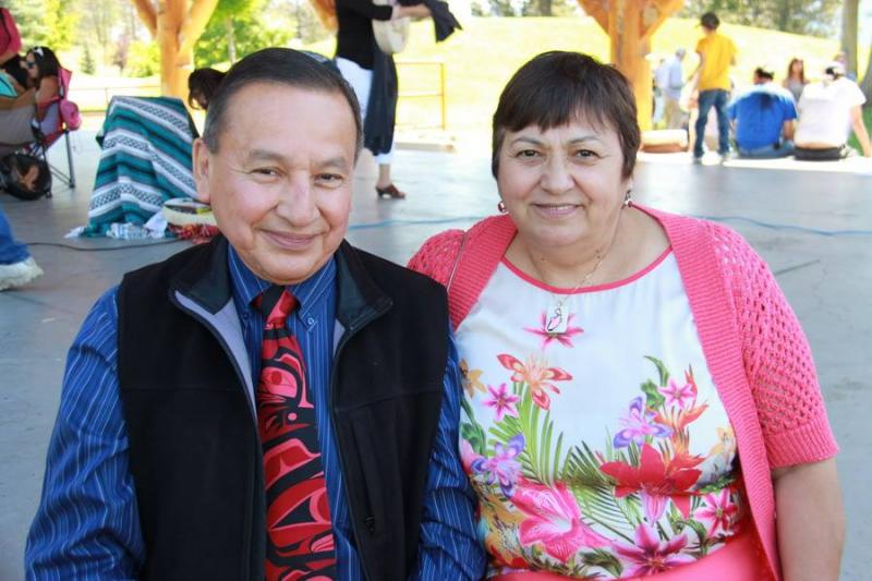
Grand Chief Stewart Phillip and his wife Joan were there to support the Tsilhqot'in

Hundreds attended the rally in opposition to Taseko's plans

I was left to wonder, after all these years, is Canada getting ready to steal Native lands again? It's time my country finds honour and an honest job – one that relies on fair dealings, not theft. The federal Environmental Assessment hearings for Taseko's mine will continue throughout August.

Taseko's active Gibraltar mine, also located near Williams Lake

This is our final blog posting. Thanks for following us on our journey as we visited the beautiful Peace River valley, headed north to check out Fracking, then south again to Williams Lake. Now it's up to you. Write those letters to the decision makers. Lets change history together!
- Joe
Sunday, July 21, 2013
Saying goodbye to the Gas Empire
It's time to leave this crazy Gas Empire and head back over to the Pacific side of the Rockies. Eoin and David are going back to Vancouver in a rented car – but Jeremy and I are headed for Williams Lake to be there for the opening of the Environmental Assessment hearings for the New Prosperity Mine being pushed by Taseko Mines. We want to show our support for the Tsilhqot'in Nation who are opposed to this monster of a open pit copper mine.
Before leaving Fort Saint John, Jeremy and I photographed and captured video of the sights and sounds of a town high on gas.

Leaving Fort St. John - a town high on gas

We wonder how long until the bubble bursts - and what will be left to clean up when it does.
- Joe
Saturday, July 20, 2013
Fort Nelson - The strange world of fracking boom and bust
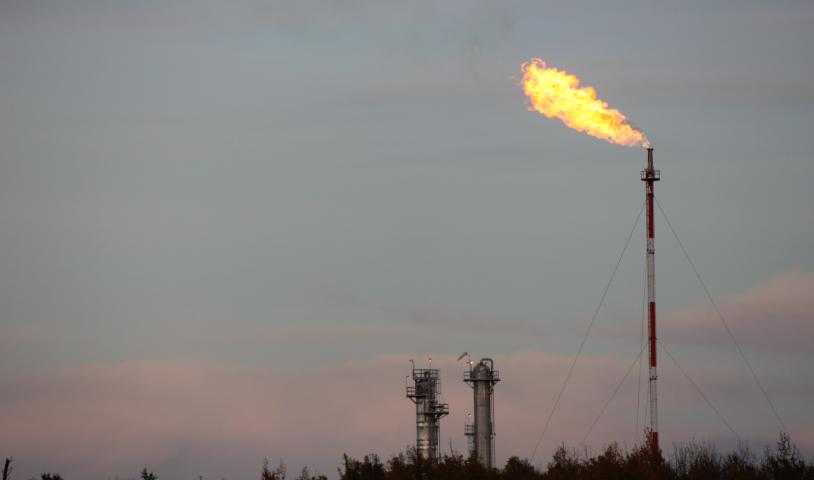
From Fort Saint John we headed north up the Alaska Highway to Fort Nelson. The scenery is spectacular wild country punctuated by gas flares and gas crew camps. Fort Nelson is a community in the vice grip of the gas industry.
Locals told us that camp workers are not allowed to come to town, so local businesses are struggling to find customers. Fort Nelson, for many long-time businesses, is a bust surrounded by the Frack boom. Even the Frackers are starting to slow down in the face of record-low gas prices.
We made our camp on the shore of pretty little Parker Lake and interviewed local resident Knute – who expressed concern for the area's fish and wildlife under an onslaught of water removal, pollution and industrial fragmentation of habitat.
Knute shares his fracking concerns with Eoin and David

Eoin at Parker Lake
The next day we headed to the Fort Nelson First Nation Lands Office to meet with Lana Lowe, who is in charge. We looked at a map showing a massive area of their territory the size of southern Vancouver Island that will be the next target of the Fracking industry.

The Fort Nelson First Nation Lands Building

Lana shows the crew a map depicting areas of the Nation's territory threatened by fracking
In the hallway we saw a poster announcing a study about the safety of local water sources.
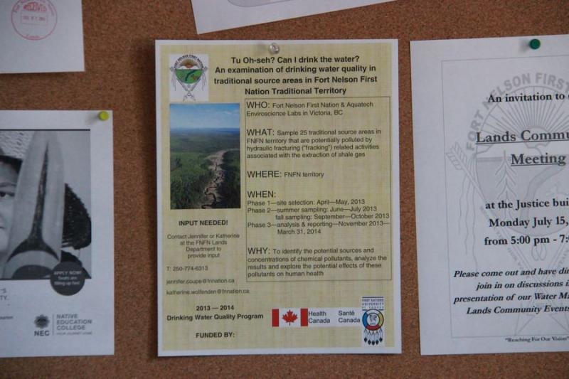
The impact of fracking on drinking water sources is a constant concern in the community
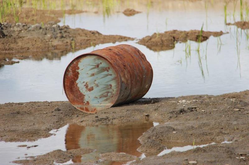
In the afternoon, acting on a tip, we hiked into a site where the fracking industry dumps its waste. It wasn't a pretty sight – or smell.

A fracking wastewater site near Fort Nelson
Then, in the middle of this polluted industrial site, we saw a sight we could scarcely believe. A beautiful Sandhill Crane was living here. It was a stark reminder about the transfer of fracking's poisons to local wildlife populations.
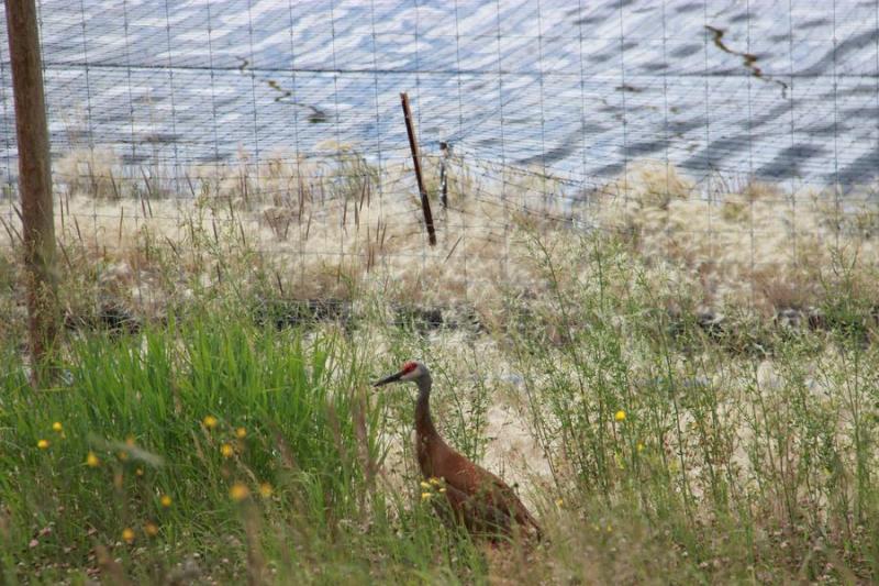
A Sandhill Crane at the industrial site
We left Fort Nelson with a great respect for the people facing the northern frontlines of the Frack frenzy.
- Joe
Thursday, July 18, 2013
Hunting frack sites from the air and on the ground
Yesterday, I drove David and Jeremy to what looked like a pretty little farm near Charlie Lake, just north of Fort St John. But instead of hay, helicopters sprouted on these fields.
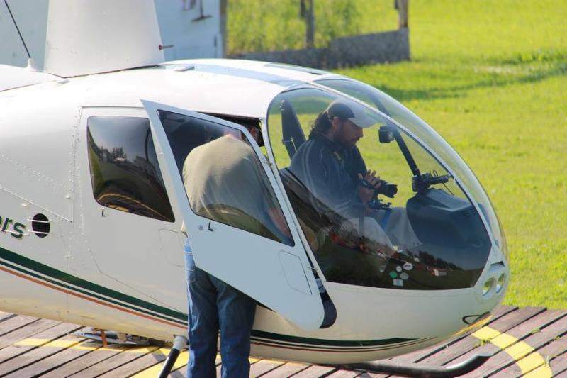
Jeremy and David prepare for takeoff

David and Jeremy were soon to be airborne, hunting for frack sites to photograph. They didn't have to look long.

Aerial photo by Jeremy Williams
Aerial photo by Jeremy Williams
The photos tell the story. Fracking turns a lot of water to poison.
Later on we drove north, towards Fort Nelson. We had heard that there were a number of frack sites we could visit on the way near Pink Mountain. Sure enough, we soon tracked one down and were surprised to find a pump chugging away, piping water out of a nearby creek to fill an empounded pond in order to feed the fracking operations.
Pumping water from a creek near Pink Mountain
Today we left camp and arrived in Fort Nelson – stay tuned for more on this next leg of our adventure in the days to come!
- Joe
Wednesday, July 17, 2013
Having chatted with the community in Dawson's Creek about the effect fracking is having on their available drinking water, we went on a fact-finding mission yesterday to witness it all firsthand. We found ourselves on a logging road at Farrell Creek which had been commandeered by frackers to provide access to their drilling pads. We chatted with local farmer Terry who attributed his dry well to the fracking operations that broke out just around the time when he began to notice a sudden drop in water levels.
Feeding the animals at Terry's farm
We found ourselves in wilderness that had been heavily industrialized, with pipes and towering derricks at short intervals along the roadside.

An industrial site like many others along the road
Ponds containing fresh water waiting for injection underground flanked us, leading eventually to an enormous pool of spent fracking water. We stopped to film at poolside, and my lungs and eyes were soon struggling against the irritants that hung in the air.
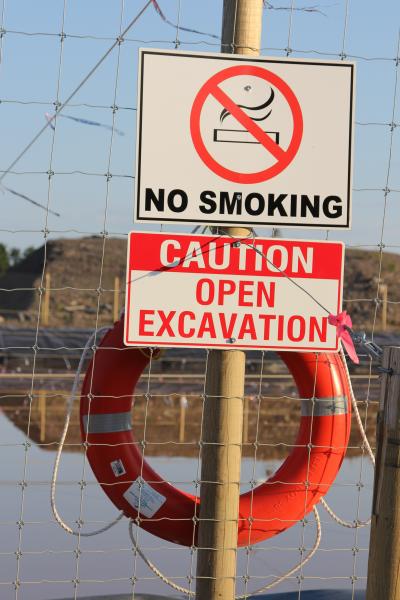
Instead of a "no diving" sign a "no smoking" sign confirmed what my headache was telling me: this was a toxic place! Cannons boomed alongside us to keep the birds from landing here. I was glad to get back on the road.
- Eoin
(Scroll down for more photos of the toxic pool in Joe's last blog post)
Tuesday, July 16, 2013
Going underground at the WAC Bennett Dam
We took the official tour yesterday at the massive WAC Bennett Dam. We heard a lot about how much water the dam holds back and how much power it produces – but not a word about its environmental impacts.
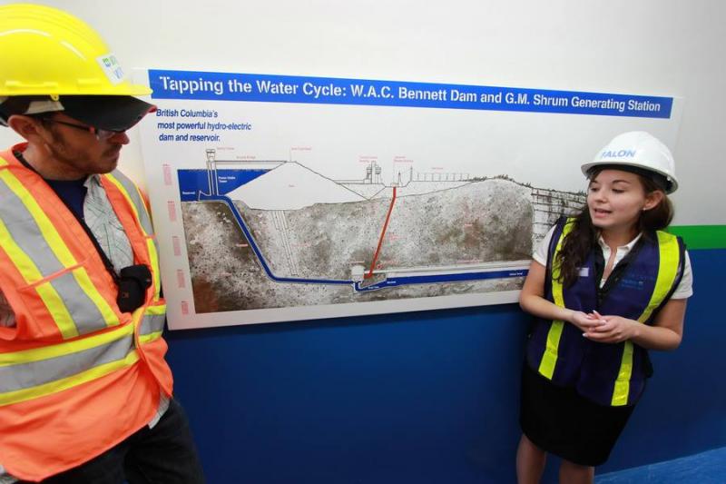
Eoin listens as the guide explains how the dam works
In fact, when I asked our guide if the reservoir's fish had become contaminated by mercury, as has happened at eastern Canadian dam sites, I was told, "No – the local waters are pristine." The truth is that the fish here are so contaminated by mercury that there is a consumption limit of one and many locals will not eat them at all.

Overlooking the Williston Reservoir, the site of the WAC Bennett Dam visitor centre
The flooding caused by the dam back in the 1960's has resulted in the local caribou herd dwindling away to nothing.
I left the dam tour sad at the lack of real information, and determined to fight the proposed Site C dam. Surely enough damage has been done to the Peace River Valley.
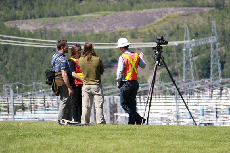
Guides at the dam discuss electricity generation with our camera crew
Tracking frack water
Near the WAC Bennett Dam site, we came upon a new pump station that was sucking water out of the Williston Reservoir for the fracking industry. This was the source for a fresh water pipeline that headed out to the fracking operations.
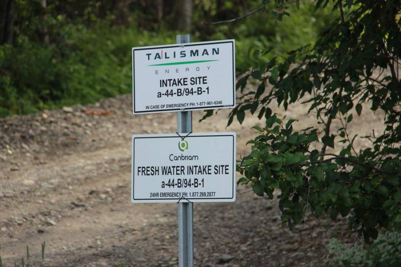
Signs near the water intake site
A worker and buildings onsite
David and Eoin exploring the shores of the reservoir, where the industry draws fresh water for fracking operations
On the hunt for the curved bridge
We drove to the Dawson Creek area to find the Kiskatenaw River. It has a spectacular curved wooden bridge over it and we knew it was a site that fracking operations draw water from.

The curved bridge over the Kiskatenaw River, where locals say water levels are decreasing
We had been told that sometimes water gets very low – and that this is a problem because it is a water source for the city of Dawson Creek.

This river provides water for the city of Dawson's Creek – and for fracking operations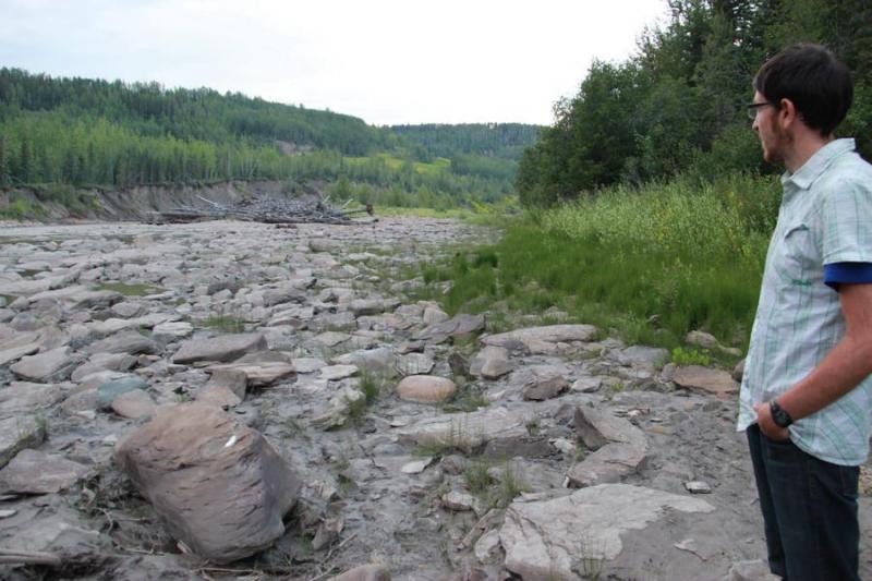
Eoin looking out at the rocks in the drying riverbed
The Mayor who stands her ground
Today we visited Gwen Johanssen, the mayor of Hudsons Hope.
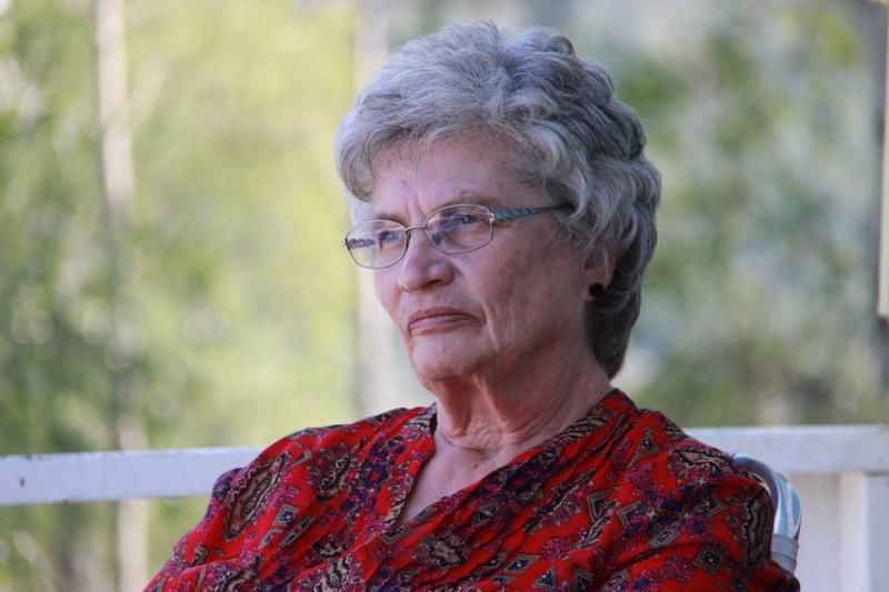
Hudson's Hope Mayor Gwen Johanssen at her home

Interviewing the Mayor about her views on the Site C dam
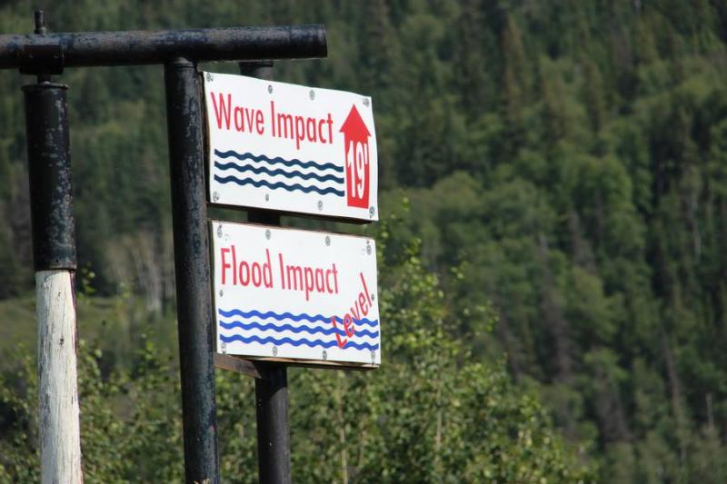
If the Site C Dam were to be built the Mayor's home would be under water. She's been battling this dam project for over 30 years.
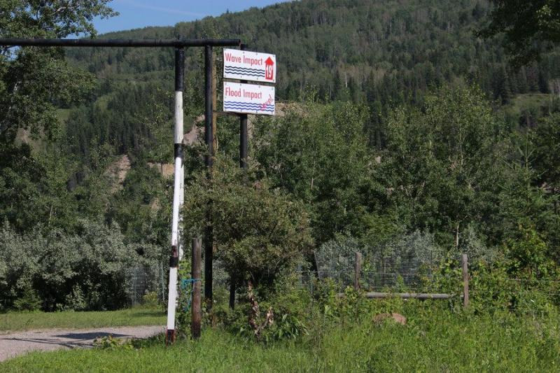
Flood level signs on Mayor Johanssen's property show the extent of the potential damage from Site C
Where the smell of water burns
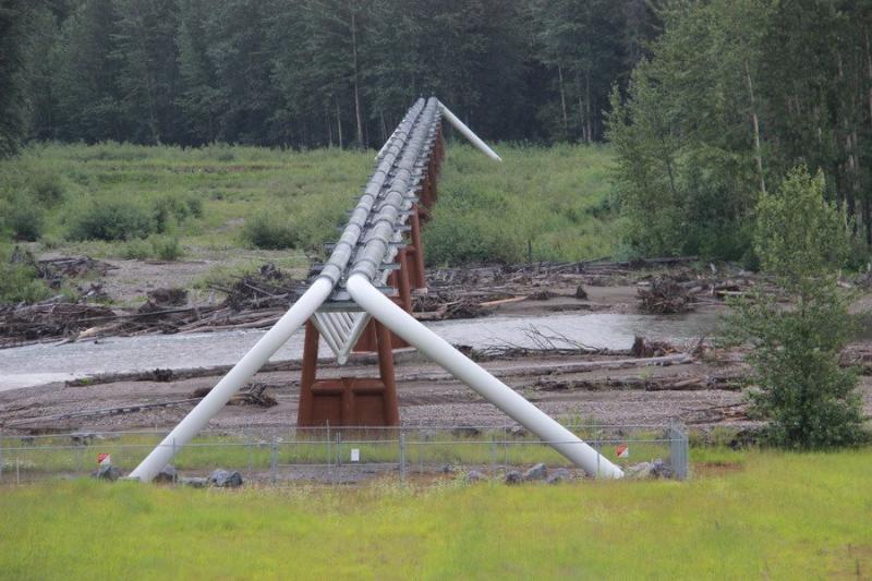
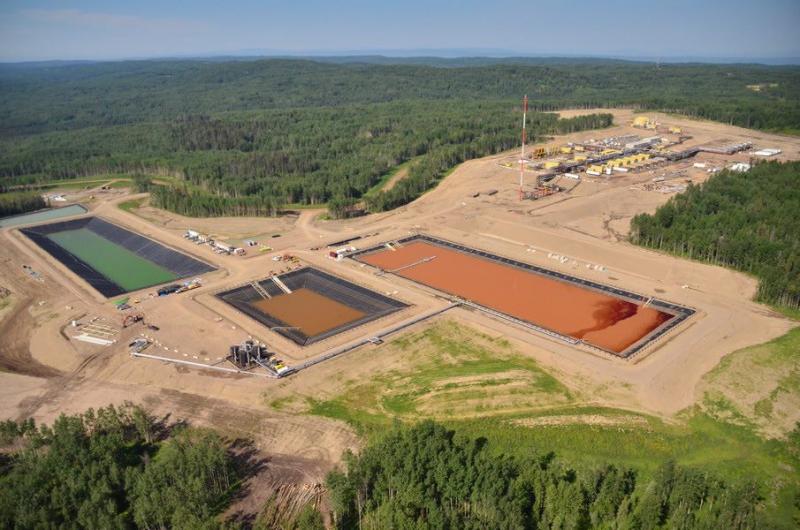
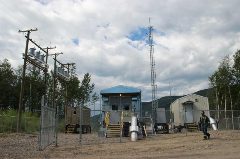
Later, we found where the frack water pipeline from the Williston Reservoir goes – about 12 kilometres away. It ends up in a steel tank where frack water trucks come in to load up.

A tanker truck arrives at the water supply site
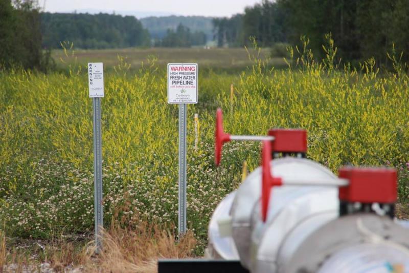
A high pressure pipeline transports water from the reservoir
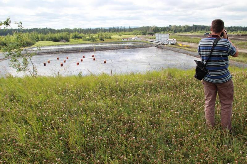
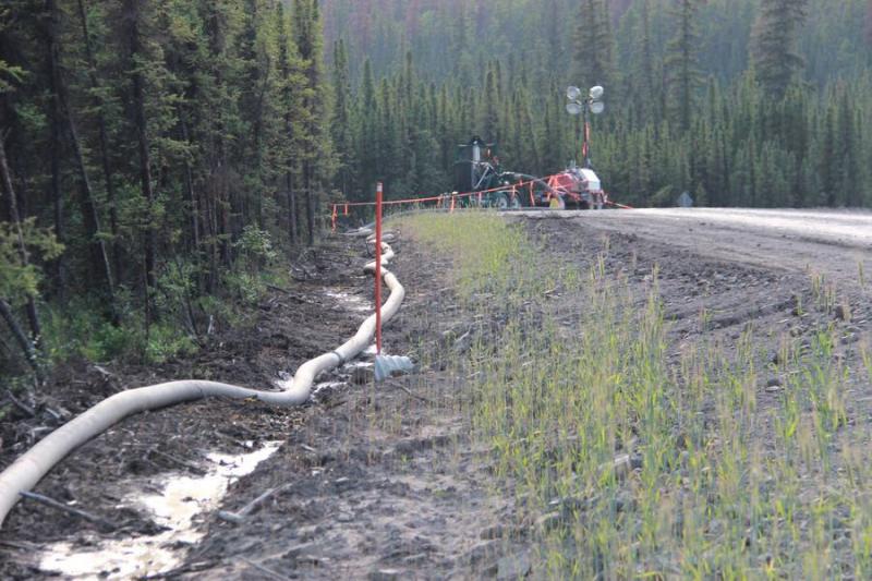
We also found where water goes once it has been loaded with chemicals and used in the fracking process. It's dumped in huge waste ponds.
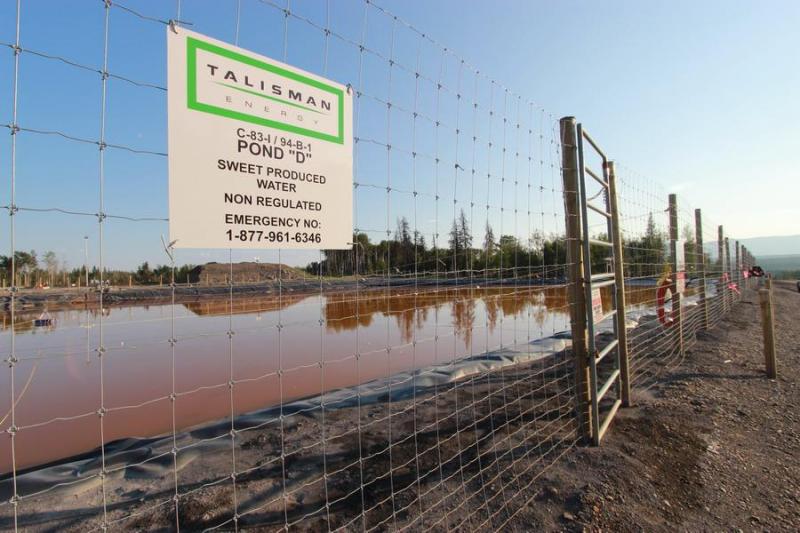
This pond of contaminated water is no swimming pool – the noxious fumes cause your eyes to burn
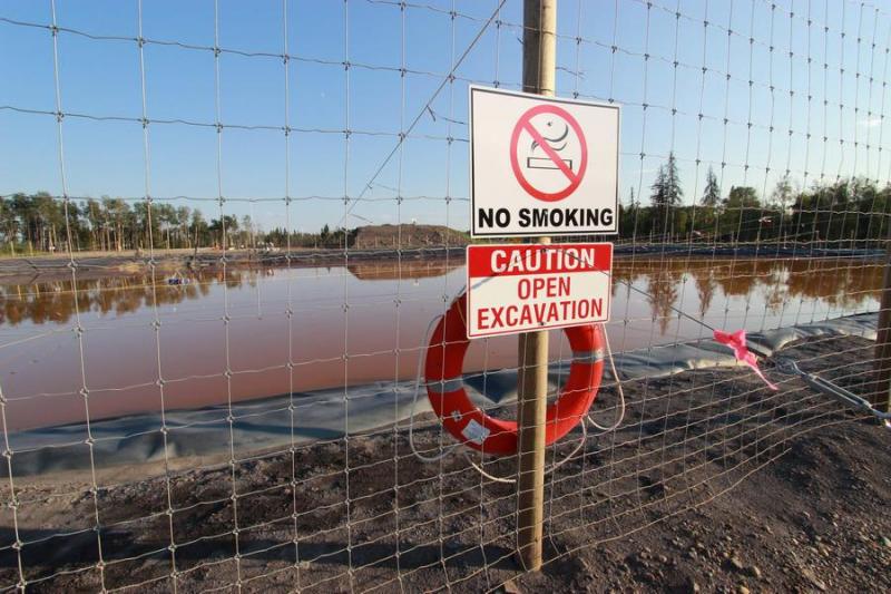
Strips of foil flutter in the breeze in an attemp to scare off water birds. Propane cannons fire at regular intervals to prevent wildlife from taking a fatal drink. No smoking signs ring the pond.
Get close to the pond and your eyes burn. Frack water trucks constantly rumble by.

A sign warns passersby of sudden noises, used to keep animals away from the hazards.
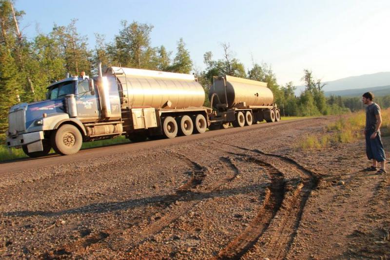
Eoin watches as a water tank truck passes
It's an eye-opening experience to see firsthand the impacts this industry is having on the land and water here in BC's north.
- Joe
Sunday, July 14, 2013
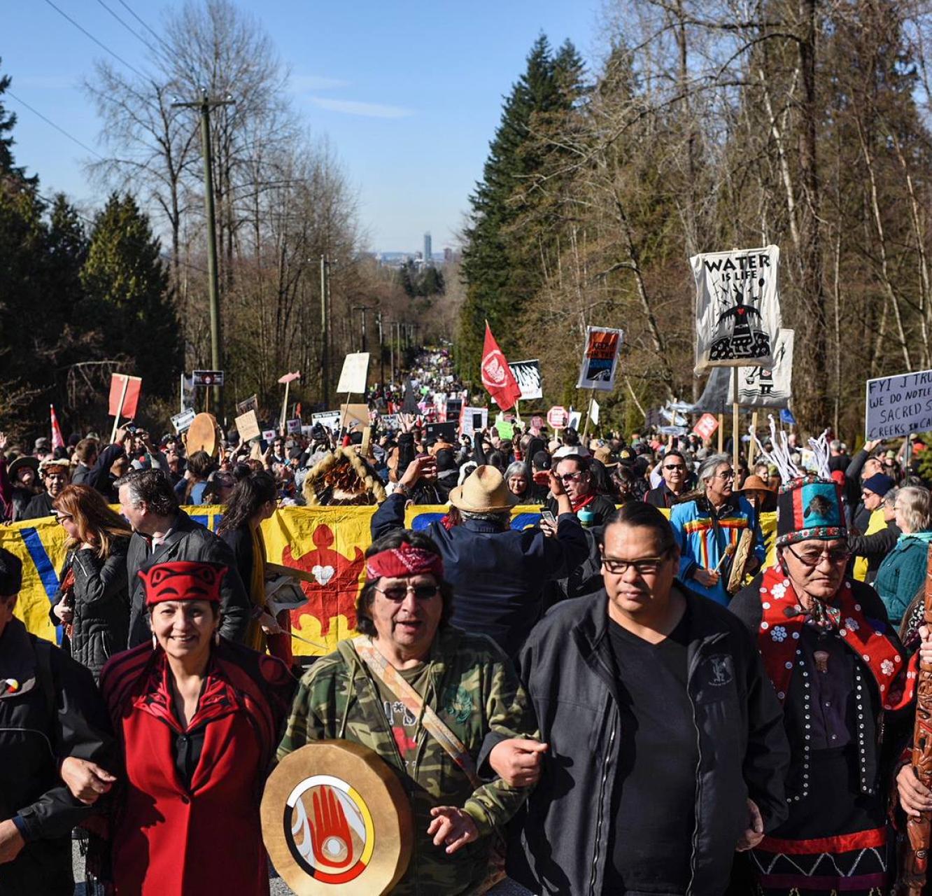
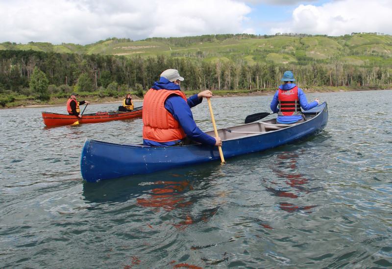
The Paddle for the Peace gathering on Saturday was a great chance to reconnect with old friends – and the great river. It was especially inspiring to hear from the First Nations speakers. 400 people came together to show their support and passion for protecting the beutiful Peace River Valley from the proposed Site C Dam.
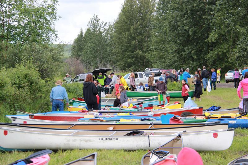
Preparing for the canoe launch at Saturday's event
The river paddle was awesome, seeing all the canoes, kayaks and river boats coming down the river. At the end of our paddle, drummers from the Treaty 8 First Nations drummed us in to shore. The sound of all the drums echoing over the river is something I'll never forget. Then there were burgers and hotdogs on the BBQ to be eaten, kids riding horses around the farmland, elders talking about their determination to protect the land – a very fun and inspiring time.

Kids on horseback during the post-paddle festivities
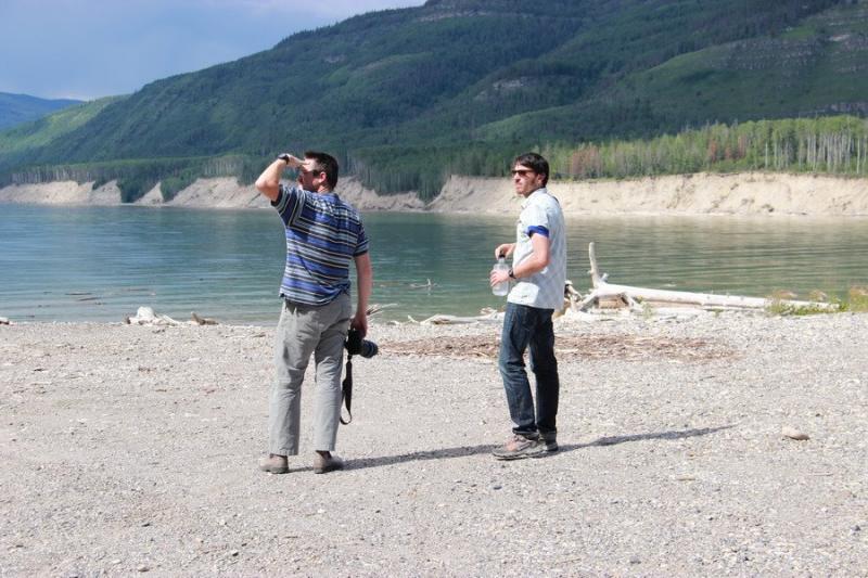
The next day we visited Ken and Arlene Boon at their farm at Bear Flats. The area got its name when Alexander Mackenzie noted seeing "two hideous and grizzled bears" – presumably grizzly bears – during his up-river historic trip in 1793.

Ken and Arlene at Bear Flats farm, where the flooding from Site C would drown their land
This heartbreakingly beautiful farm would be flooded out if the Site C Dam were ever to be built. But Ken and Arlene are determined to stand for their land, which has been in the family since the time of Arlene's grandfather.
- Joe
Sunday, July 14, 2013
I paddled for the Peace for the first time yesterday with my fellow paddler Joe Foy, and learned so much on the water from him. The idea that such a beautiful place, and such an productive place, could be sunken underneath masses of water is just obviously misguided.

Eoin in the canoe during his first Paddle for the Peace event
The emerald green Peace ebbs and flows alongside rich fertile fields of produce, and we were generously hosted by local farmers and First Nations at both ends of the paddle route. Talking to them it quickly became clear just where the pressure exerted on the BC Government to drown the Peace is coming from: we have more than enough energy to take care of our own household needs, but the energy hungry Gas Industry is pushing for its construction.
Paddling alongside other British Columbians who don't want to see this precious valley flooded
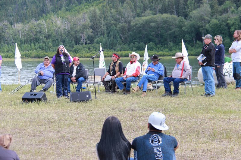
Representatives from the West Moberly First Nation speak to the crowd

Sending a strong message: the people of the Peace say NO to Site C
They want the subsidized energy and free water to continue fracking the lands of the north, and to then freeze the resulting gas on the coast for export. All day the rumbling water trucks thundered up and down the freeway alongside us, announcing that we are in fracking country. Industry is shaping up for a major push for new well sites in the area, with locals bracing themselves for 4000 new pads. There is no balance, its "drill baby drill", and it is the generous folks of the Peace that will pay the price.
- Eoin
Thursday, July 11, 2013
Today was our first day travelling north to attend the Paddle for the Peace event. We spent the day on the road with videoographers David Lavallee and Jeremy Williams, and riding shotgun was Wilderness Committee climate campaigner Eoin Madden.
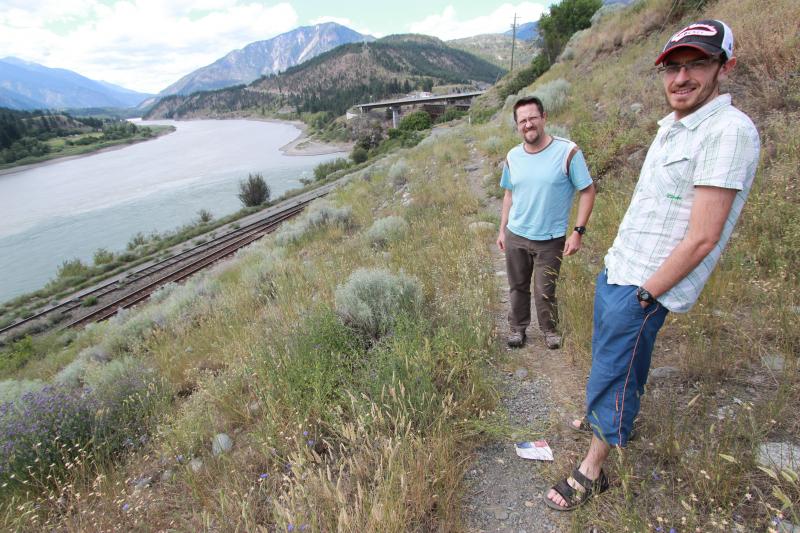
Eoin and David during a stop near Lytton, BC -- overlooking the confluence of the Fraser and Thompson Rivers
We were following beside big rivers like the Fraser and Thompson all day. Seeing this landscape makes us understand what's at stake in the fight to save the Peace River from the proposed Site C Dam.
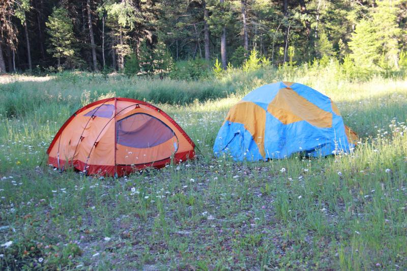
Ready to spend the night at our campsite north of Williams Lake, BC
In the evening we camped in a flower filled meadow just north of Williams Lake – and David and Jeremy set to work filming our journey. After some rest, we'll be ready to head further north towards Fort St. John, just in time for Saturday's big event – Paddle for the Peace!
- Joe
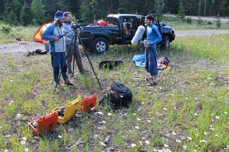
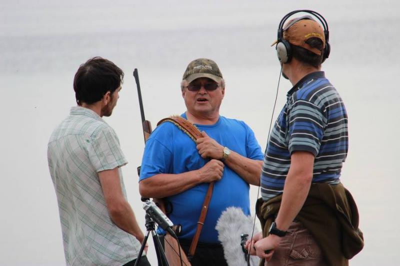
Eoin lending a hand as the film crew sets up their gear

Beautiful wild daisies in the meadow surrounding our campsite
These blog posts will continue through to the end of July, as Joe and Eoin travel further north – to the Fort Nelson area to document the environmental impacts of hydraulic fracturing ("fracking") for the production natural gas.
Then, starting on July 22, Joe will be in Williams Lake following the opening of the Environmental Assessment hearings regarding the so-called New Prosperity Mine – which threatens the environment around Fish Lake on the Chilcotin Plateau.
Stay tuned - it should be a wild ride!
|
Take Action! Click here to write a letter to BC Premier Christy Clark, urging her to put an end to plans to build the Site C Dam. Click here to read more about fracking in BC and tell to decision-makers to put the brakes on the province's gas industry. Click here to write to the Canadian Environmental Assessment Agency panel, telling them to protect Fish Lake and say "No" to the New Prosperity Mine |