New Downloadable Maps of the Kinder Morgan Pipeline Route
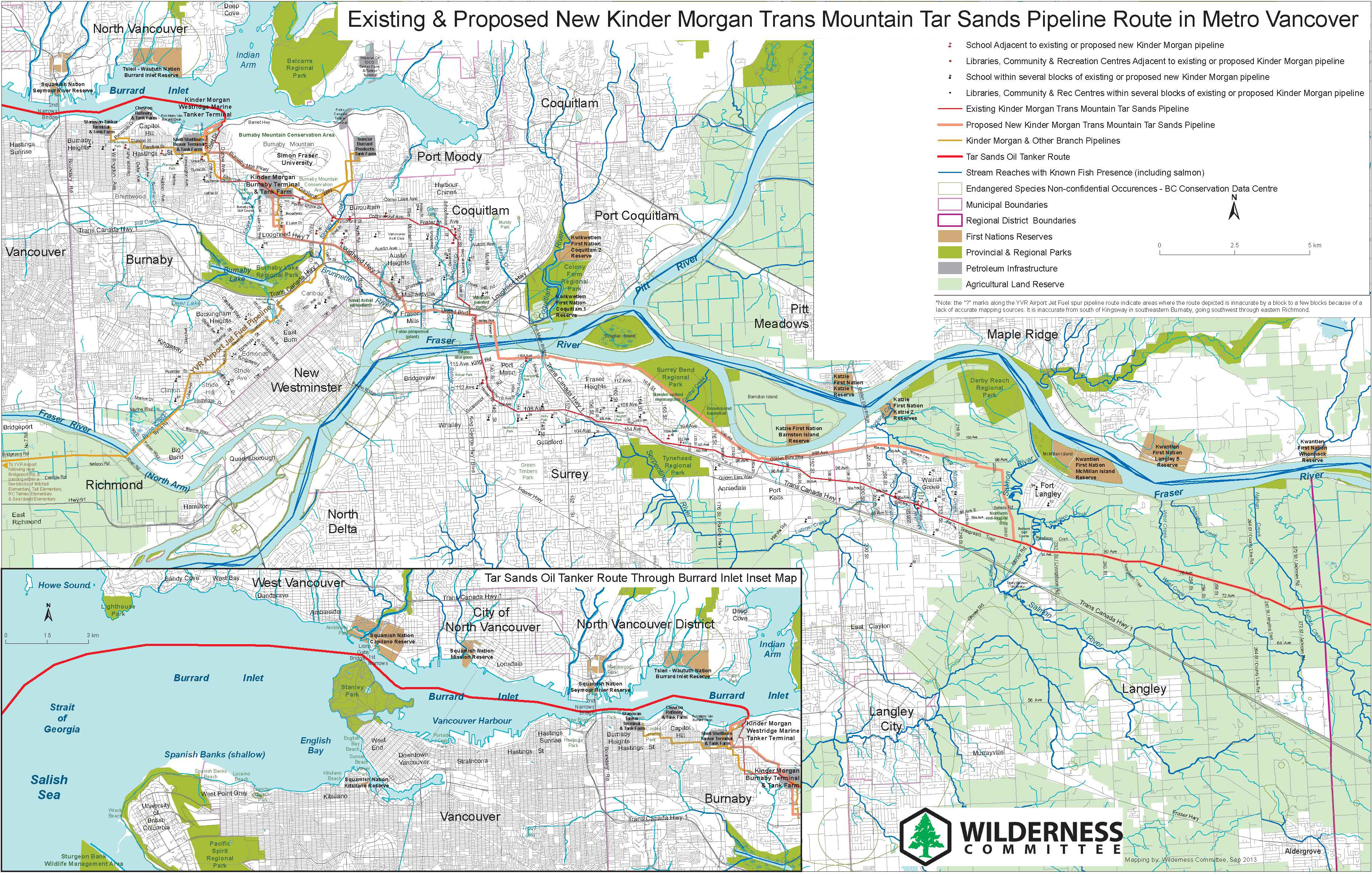
The Wilderness Committee has produced a series of maps of the Kinder Morgan Trans Mountain pipeline route, as a way to help educate people about the many natural areas, rivers, wildlife habitats, and communities that would be affected in the case of an oil spill.
These new maps were updated in September 2013 to include the most up-to-date route information, as well as highlighting schools, community infrastructure, waterways and endangered wildlife habitats that are crossed by the existing pipeline route.
The route of the proposed new Kinder Morgan pipeline – which was intended to run alongside the existing route – can be viewed in more detail using our interactive Kinder Morgan pipeline map. The interactive map allows viewers to zoom in on satellite images and illustrates the route of the proposed pipeline in relation to the existing line.
Click on the links below to download the maps large versions in PDF format.
Trans Mountain Pipeline in Metro Vancouver
Detailed community-level map including schools, waterways and endangered wildlife habitat along route
Download this map in pdf format
Trans Mountain Pipeline in the Fraser Valley
Detailed community-level map including schools, waterways and endangered wildlife habitat along route