South Okanagan-Similkameen national park debate reopened
Penticton Western News

The province has reopened the debate on a national park in the South Okanagan-Similkameen, albeit with some modifications.
On Aug. 13, the B.C. government released an intentions paper and invited public feedback regarding protection options in the South Okanagan-Similkameen.
The paper details policies related to three distinct areas in the region. The province is proposing a large area, west of Osoyoos and south of Highway 3 to the U.S., be considered by Parks Canada for inclusion in a South Okanagan National Park Reserve.
Likewise, part of the White Lake basin and extending down past Willowbrook, west of Hwy. 97, is also being put forward for national park status. Between them, the two cover several protected areas, including the White Lake Grasslands, Spotted Lake, the Osoyoos Desert Centre and the South Okanagan Grasslands Protected Area sites of East and West Chopaka.
A third area, covering west of Oliver towards Cawston, and north of Highway 3 to the southern border of the White Lake Grasslands, is being recommended as a conservancy under the B.C. Park Act.
Gwen Barlee, policy director with the Wilderness Committee, is pleased the province is revisiting the national park concept. Parks Canada concluded its own feasibility study in 2011 and recommended the province adopt at a conceptual level the boundaries for a 284-square-kilometre park, but the federal agency shut down its work when the B.C. government walked away from the process in late 2011, giving lack of public support as the reason for withdrawing.
“There are still many questions that need to be answered, and the park size is smaller than we’d like, but this development is a very positive step forward,” said Barlee in a press release. “We are thrilled to see that the Minister of Environment Mary Polak recognizes the incredible ecological importance of this region and that the provincial government is exploring ways to protect it through a national park designation.”
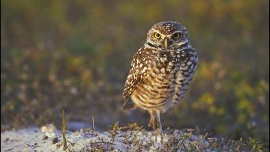
The release also notes that the arid South Okanagan-Similkameen region is one of the four most endangered ecosystems in Canada, and is home to 30 per cent of B.C.’s endangered species, including badgers, rattlesnakes, bobolinks (a type of bird) and burrowing owls.
The announcement Thursday kicks off a 60-day period for the public to comment on the intentions paper, closing Oct. 12, 2015. BC Parks will review the feedback and publicly post a consultation report, along with final recommendations in early 2016.
In the government’s news release, Polak is quoted as saying the government is committed to exploring a variety of options to satisfy the varying interests in this diverse region.
“Our intent with these proposals is to protect significant geographic and cultural values, while providing recreation and tourism opportunities,” said Polak.
Greg Norton, a fruit grower in the Oliver area and a member of the Grasslands Park Review Coalition, said he was “a little shocked” to hear the province was returning to discussion of the national park concept.
“There is a lot to the document. It’s a bit early to make any definitive comments, but what I see in that document is more questions than answers,” said Norton, who added that he remains opposed to any form of a national park, of any size.
“We have always said the Land and Resource Management Plan should be the basis of future development. That was a four-and-a-half year provincial exercise with all the stakeholders involved and consensus was reached,” said Norton. “But, it is a consultation process, it’s not the final word.”
Penticton MLA Dan Ashton said public input is key to the process of finding a solution meeting the interests of the area, though he downplays the national park.
“They are looking at a proposed land management area there, and consideration of a national park is part of that,” said Ashton. “I really think it is important to engage the people. It is especially important to engage the First Nations because they have shown a strong and expressed interest in the area.”
Linda Larson, MLA for Boundary-Similkameen, which contains the areas outlined in the document, was on vacation and unavailable for comment.
The intentions paper and maps showing the affected areas is available online at www.env.gov.bc.ca/bcparks/planning/protected-areas-framework-s-okanagan.html.
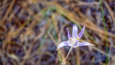
Photo Credit: Gwen Barlee via WC Files


