Wetlands, Wetlands as far as the eye can see

There was great excitement in me as I motored down the road last week, finally heading up into northwestern Manitoba. I had a list of the areas I wanted to investigate and the photos I meant to shoot. Five days and 1,800 kilometers later I’m back in the office, trying to process the overload of information, sights and sounds, and photographs.


The first adventure was checking out the edges of the Saskeram, part of the Saskatchewan River Delta, one of Manitoba’s Conservation Hot Spots. The Saskeram has no roads in, and is bordered by the Carrot and Saskatchewan Rivers. I knew without a boat I wasn’t going to see much, but I skirted the outside, peering in, and thought about the treasure these two rivers are guarding. It wasn’t until I arrived at my next destination that I got a sense of the enormity of the Saskatchewan River Delta.

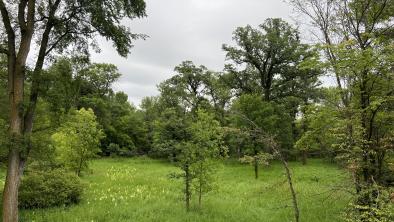
Straining my eyes to see the end of the wetlands
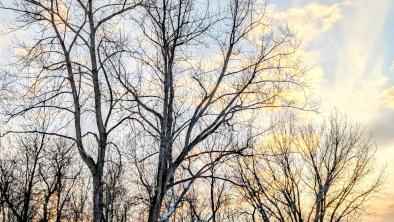
I sometimes talk to myself while travelling alone, and when I got my first expansive glimpse into the Tom Lamb Wildlife Area I let out an exclamation. The lowland ecosystem surrounding the Saskatchewan River or Rosebud Creek dwarfs everything you can imagine. In some directions you can see 10 kilometers before a ridge of trees pops out of the swamp. The amount of water being stored and filtered here is staggering. Imagine the amount of carbon tied up in these lowland bogs! While I stood snapping pictures of the sunset after a 15-hour day of exploring, the bird calls were a symphony, loud and vibrant, that seemed to recharge my soul for the next day’s expedition. At dark I motor off to a gravel pit I scoped earlier, to sack out in the truck until sunrise.

Look for further blog posts from this trip on the Woodland Caribou campaign page and on the Canada's Boreal Region campaign page.
- Eric Reder

Sunset over the Saskatchewan River Delta


