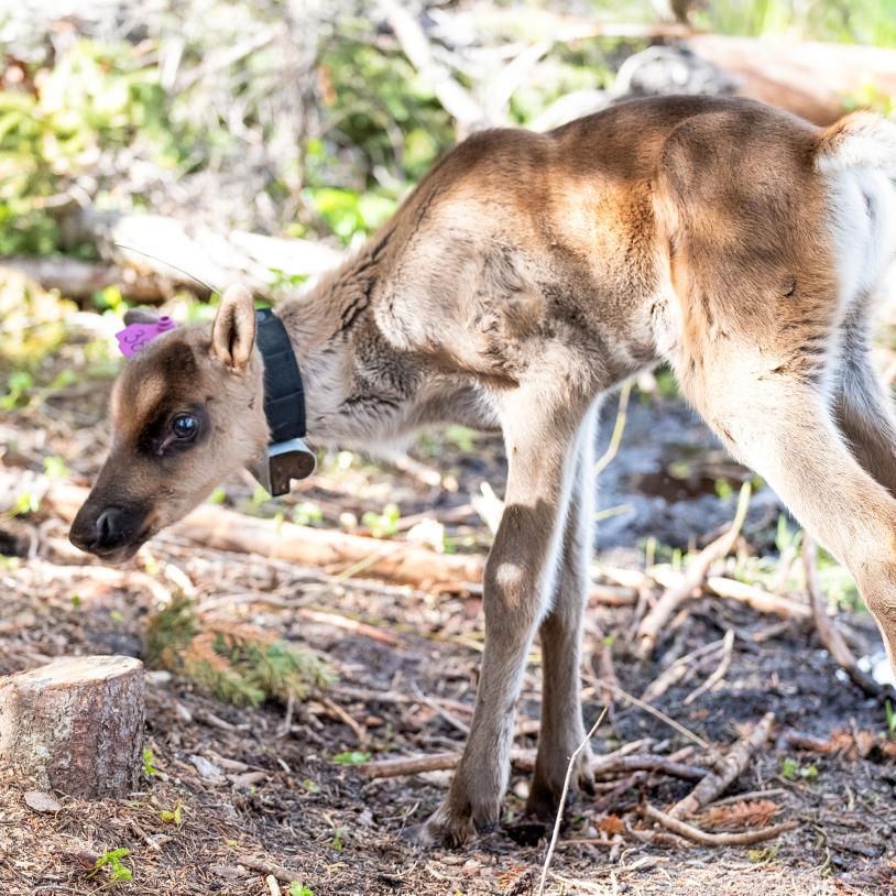
Where to, caribou?
Saturday, August 14, 2010
August 8, 2010
In the afternoon of day three on my northwest Manitoba odyssey, I looked over a map the Manitoba government had grudgingly released in 2009, showing the location of logging operations, recent forest fires, and woodland caribou observations in Northwest Manitoba. I headed up to the range of the NAOSAP caribou. A massive forest fire in the early summer scorched over 55,000 hectares of this forest, and I wanted to survey the site for myself. I checked out the multitude of clearcuts and roads in the range of the NAOSAP caribou, reportedly one of the herds at the highest risk of decline.

It was easy to see why these grey ghosts were considered at risk, as caribou don’t like disturbances. In fact, a study in northwest Ontario found caribou can move up to 20 kilometers away from a clearcut within a couple years of logging. At kilometer 47 on the Sherridon road, I finally found a road to take me into the core of the NAOSAP range. I packed my emergency gear and camera gear, and headed down the trail. A few minutes in I found what I was expecting—the edge of the fire. The darkened forest was brightly lit even in the low-slung cloudy overcast, with branches devoid of leaves and needles casting little shadow. The smell of burnt wood was strong and everywhere, but as you stopped among the charred trees, the unusual sound was what struck you. Individual screechy crunching sounds could be heard from all around, the only sound breaking the blackness. Beetles are eating the dead trees. If you focus on them you can hear individual bugs chomping just under the bark of near every tree, several bugs in most trees. Little piles of white sawdust have settled onto the dark carpet at the base of many trees. The sound is overpowering if you concentrate on it, it rings and echoes from all around, every which way you turn. Nature is making use of the dead wood, bringing the nutrients around to be used by someone else.

When you look around you can see the speed that the fire travels through an area. Quick fires leave a charred surface, but the underground root structures are spared the devastation. Re-growth is already happening, mere weeks after this natural disaster ran through. There are green shoots coming out of the clumps of deciduous trees. Some of the moss and lichens are still growing, and contrasted in a hauntingly beautiful way in this charred landscape are the purple-pink blossoms of fireweed.

As the sky got heavy with rain I hoofed it back to the truck, thinking about this fire. I was later told that the fire burned south from here, right through the core of where the NAOSAP caribou had been living, and into Grass River Provincial Park. I knew about the number of clearcuts, and number of fires that had impacted this area. In eastern Manitoba, the Owl Lake-Fintstone range of woodland caribou (one of the other high-risk herds) has been hemmed in on nearly all sides by development, and development is encroaching yearly. The habitat for the NAOSAP herd keeps getting taken away, too. This fire is a huge blow for caribou in this region. Their primary food, Cladonia rangiferina, commonly known as reindeer lichens or moss, really only exists in older forests. Burnouts and clearcuts don’t offer much for caribou. All the roads being pushed in help predators and not caribou, who are adept at travelling through the bogs with their dinner-plate-sized hooves. All I kept thinking was the simple question: Where to, caribou?
The following morning the air was laden with moisture still. This was not to be a great photo day. I started out to document some areas where the NAOSAP caribou might go, or might have been. I wanted to see good caribou habitat. Looking at more maps and more forest I found some promising areas. I even found wolf scat that had suspiciously thick hairs in it. Were there wolves here preying on young caribou?

Only a quarter of caribou calves are expected to make it every year. Maybe I was on the edge of caribou? Maybe they were close?
Trees are deceptively small in this north country. Is that black spruce, just 20 centimerters in diameter, 20-years-old or 80? You need to look at the surrounded forest to figure out if this is old or new, and sometimes you can’t even tell unless you count rings. I continued on to some other areas, and wandered into another promising forest. The high rock ridge was covered in pines, a ways in from a black spruce bog. The bog provides cover and the open rock ridges provide growing space for reindeer moss. After a few minutes of walking I returned to the truck dejected. The pine trees were very nicely spaced apart on the rock ridge—too perfectly placed. You could see areas where the forest was thinned, half the young trees cut down by loggers so the remaining trees will grow faster with no competition for sunlight and nutrients. That’s all well and good for a tree plantation, but doesn’t make a healthy forest ecosystem. Closer investigation revealed stumps from when this was clearcut. The trees were still young, and this was not the forest caribou usually prefer.
Further down the road I geared up to wander out again—knee brace on, rain gear on, set a waypoint in the GPS, grab the camera bag, tripod, and backpack with essentials. I carry a lot of gear when I work, because I’m by myself in the middle of nowhere. The pack has the satellite phone, emergency tarp and safety blanket, fire starting kit, first aid kit, headlamp, bug spray, bug head-net, sun and rain hat, compass, a couple Clif bars, and a stainless steel water bottle. This to me looks like caribou land. The muskeg is deep, and it’s hard walking. There are short black spruce spread around, and low rock islands pop up here and there. The rocks are covered in reindeer lichens, and I think I’ve finally found what the caribou want.

After shooting some photos the rain picks up again. My Nikon is very resistant to moisture, but I can’t keep the rain drops off the lens element, and the droplets are showing up in my photos. I’m satisfied, though, that I’ve found the caribou habitat I was looking for.

— Eric Reder


